GIS Permit Search Tool
The "Geographic Information System" (GIS) Permit Search Tool provides permit and parcel related geographic information, including map production and geographic analysis.
While no log in is required to search, you must have a log in and be signed in to your account in order to save or download your search results.
Searching by using the GIS Permit Search Tool
Follow these steps to conduct a search using the GIS Permit Search Tool:
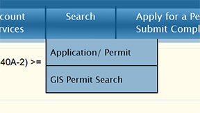
Step 1: Navigate to the search screen
From the Home Page, navigate to Search, and select GIS Permit Search.
Step 2: Enter your search criteria
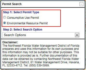
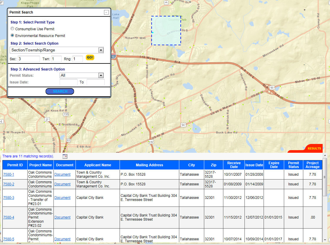
Selecting the GIS Search Tool option will open a new window to the GIS Search Interface (pictured below).
a. Select either Consumptive (Water) Use Permit (WUP) or Environmental Resource Permit (ERP).
b. From the drop-down menu, select a search criteria: County, Section/Township/Range, Permit Number, Project Name, Applicant Name, Address, Longitude/Latitude, or Map Drawing Search.
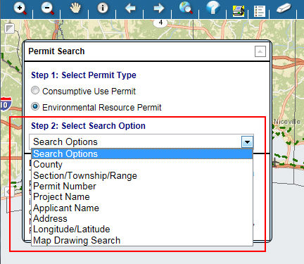
c. Enter the particular data for the search criteria selected.
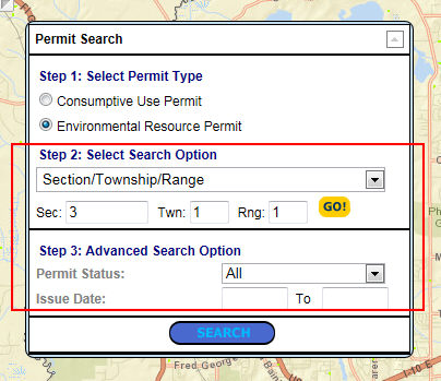
d. Click the Search button at the bottom of the window to execute the search.
Step 3: The results map will display
The results map will display the project(s) boundaries and the stations associated with the project(s).
The main window is the Map window where the map is displayed.
The window at the bottom shows the results in a tabular format.
Related Help topics
Contact Customer Support
![]() If you're looking for more help or have
a question to ask, please contact
us.
If you're looking for more help or have
a question to ask, please contact
us.